Two new highlighted articles on the making of the New European Wind Atlas
For the last several years Tija Sīle, a researcher from the Institue of Numerical Modelling, has actively worked on developing the New European Wind Atlas (NEWA). Together with researchers from all across Europe she has developed and introduced a new methodology for the assessment of wind conditions. The findings have been published in Geoscientific Model Development in two highlighted articles.
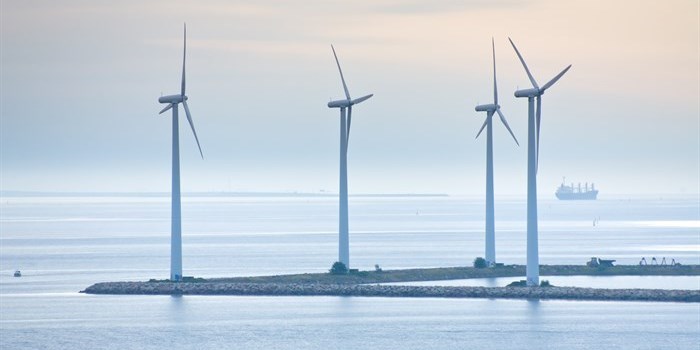
Wind atlases are defined as databases of wind speed and direction statistics at several heights in the planetary boundary layer. Wind Atlases mostly help with the wind energy installations, but also with structural design for buildings, transportation infrastructure and operation, recreation and tourism.
In 1898 the European Wind Atlas was created, the Ewa is now 30 years old and of limited usefulness, it has a very coarse spatial resolution and does not provide time series of the variables of interest. So in 2013, a team of 30 partners from 8 European countries started work on the New European Wind Atlas. The project has 3 main components – a series of intensive measuring campaigns, a thorough examination of the model chain, downscaling from global to mesoscale and microscale models, and the creation of the wind atlas database. The new wind atlas is based on 30 years of mesoscale model simulations with the Weather Research and Forecasting model at 3 km x 3 km spatial and 30 min temporal resolution and seven vertical levels.
Prior to every new wind turbine and wind farm installation, an energy yield assessment is carried out. This local energy yield assessment is typically based on a combination of wind speed measurements and model data. While the measurements are typically collected at a later stage of the planning phase, model data are used during many stages of the wind resource assessment. Thus, accurate modelling and evaluation of the modelling compared to observations is important.
To achieve this, the New European Wind Atlas (NEWA) project was created as a 4-year research project with the goals of creating such a wind atlas, the researchers collected relevant field measurements and improved the models currently used. The NEWA wind atlas (https://map.neweuropeanwindatlas.eu) consists of mesoscale and microscale datasets that cover all European Union member states, Norway, Switzerland, the Balkans, and Turkey.
The first article on the making of the New European Wind Atlas https://gmd.copernicus.org/articles/13/5053/2020/, reports the sensitivity experiments and accompanying evaluation done to arrive at the final mesoscale model setup used to produce the mesoscale wind atlas. In the second highlighted article (https://gmd.copernicus.org/articles/13/5079/2020/) the researchers have documented how they made the final wind atlas product, covering both the production of the mesoscale climatology generated with the Weather Research and Forecasting (WRF) model and the microscale climatology generated with the Wind Atlas Analysis and Applications Program (WAsP).